MANITOU WIND RESOURCE
The Manitou site has a unique set of factors that create formidable potential toward Indigenous economic security and energy independence on Southern Vancouver Island -
a strong wind energy resource - high and consistent wind from two primary directions only - winter peaking
proximity to electrical infrastructure
minimal terrestrial site impact - existing site access for nearshore wind turbine installation
minimal use conflict with other uses of marine environment
cost effective development for rate payers
proximity to consumers
LOCATION
LOCATION
LOCATION
In 2005, Aeolis Wind began to study the environment and wind energy resource at Manitou.
From an energy perspective, high capacity wind depends on wind speed and constancy.
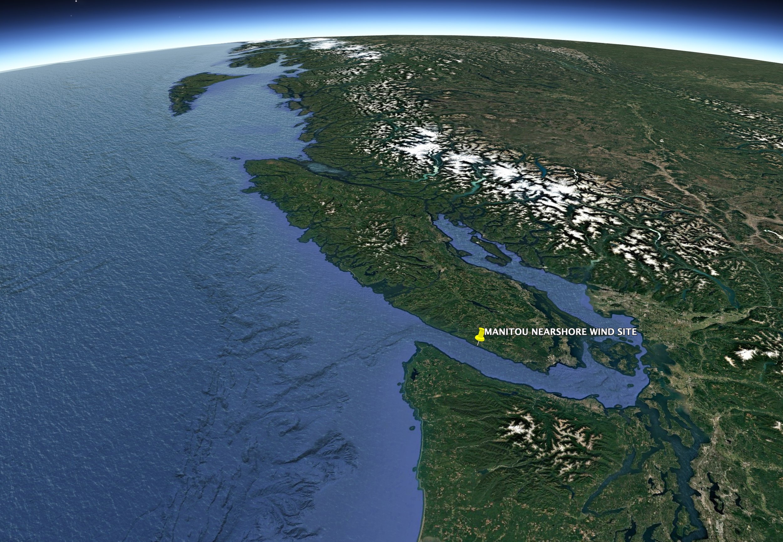
Positioned optimally along the southwest coast of Vancouver Island, British Columbia, Manitou faced the Juan de Fuca Strait.
Not far from Victoria, BC’s vibrant provincial capital city, Manitou is the first landfall for wind that travels thousands of kilometres over the Pacific Ocean from the northwest; as well as outflow winds that spill out of Juan de Fuca strait from the east .
At the intersection of these regional, orographic, oceanic and continental weather patterns, meteorological sites nearby to Manitou record some of the highest and most consistent winds on Vancouver Island
-
LATITUDE 48°26'50.63"N
LONGITUDE 124°11‘14.41"W
-
The site is located between Jordan River and Sombrio Beach, in the nearshore zone, up to 1 km from shore.
-
Manitou is located nearshore to the Coastal Western Hemlock Zone of the Biogeoclimatic Ecosystem Classification system.